Map 12914: Heard Island and McDonald Islands Marine Reserve and Conservation Zone (OUT OF DATE)
Map details
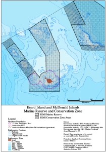
| Map Number | 12914 |
| Title | Heard Island and McDonald Islands Marine Reserve and Conservation Zone (OUT OF DATE) |
| Edition | 1 |
| Scale | 1 : 5 000 000 |
| Publication date | October 2002 |
| Publisher |
Department of the Environment and Heritage (Australia)
|
| Spatial coverage |
( 70.0000° -50.0000°)
,
( 78.0000° -50.0000°)
,
( 78.0000° -55.0000°)
( 70.0000° -55.0000°) |
| Projection | Lambert Conformal Conic |
| Physical size | 29.7 x 21 cm A4 |
| Notes |
This map is out of date. Map 14234 shows the Heard Island and McDonald Islands Marine Reserve boundary that came into effect in March 2014. |
| Keywords | Heard , Mcdonald , Marine , Reserve , Conservation , Eez |
Downloads
This is a digital map available for downloading.
Map Lists
No maps lists available.
Additional Information
| Horizontal datum | WGS84 |
Preview