Map 12925: Mawson Station Area : Orthophoto map
Map details
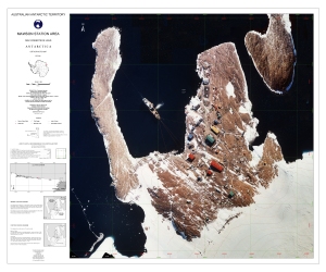
| Map Number | 12925 |
| Title | Mawson Station Area : Orthophoto map |
| Edition | 1 |
| Scale | 1 : 1500 |
| Publication date | February 2003 |
| Publisher |
Australian Antarctic Division (Australia)
|
| Spatial coverage |
( 62.8597° -67.5972°)
,
( 62.8839° -67.5972°)
,
( 62.8839° -67.6069°)
( 62.8597° -67.6069°) |
| Projection | Transverse Mercator |
| Physical size | 75 x 91 cm |
| Notes | Orthophoto compiled from colour aerial photography flown at 950 metres on 18 March 1996 and 1 March 2001. Camera: Zeiss UMK (format 120mm x 170mm) |
| Keywords | Mawson Station , Orthophoto , Survey Marks , Satellite Imagery |
Downloads
This is a digital map available for downloading.
Map Lists
This map belongs to the following lists. Use the link on the list to see all maps belonging to that list
Additional Information
| Accuracy | Topographic data used in the map has a horizontal accuracy of +/- 0.2m and vertical accuracy of +/- 0.1 m. |
| Horizontal datum | WGS 84 |
| Vertical datum | Mean Sea Level |
| Magnetic variation | 66deg 12' west |
| Nomenclature | Australian Antarctic Gazetteer |
Preview