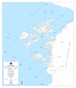
Map 12964: Rauer Group : Mapping Project - Photo control
Map details
| Map Number | 12964 |
| Title | Rauer Group : Mapping Project - Photo control |
| Edition | 1 |
| Scale | 1 : 40 000 |
| Publication date | October 2002 |
| Publisher |
Australian Antarctic Division (Australia)
|
| Spatial coverage |
( 77.5000° -68.7167°)
,
( 78.1667° -68.7167°)
,
( 78.1667° -69.0000°)
( 77.5000° -69.0000°) |
| Projection | Universal Transverse Mercator |
| Physical size | 75.5 x 65.5 cm |
| Notes | Photography flown 25/1/98 and 1/2/98 |
| Keywords | Rauer Group , Photo Control , Ingrid Christensen Coast , Browns Glacier , Torckler Island , Varyag Island , Hop Island , Flag Island , Filla Island , Lookout Islands , Slon Island , Macey Peninsula , Cape Rybachij , Mather Peninsula |
Downloads
This is a digital map available for downloading.
Map Lists
This map belongs to the following lists. Use the link on the list to see all maps belonging to that list
Additional Information
| Horizontal datum | WGS84 |
| Vertical datum | Mean Sea Level |
| Nomenclature | Australian Antarctic Names Gazetteer |
Preview