Map 13044: Heard Island: aerial photography
Map details
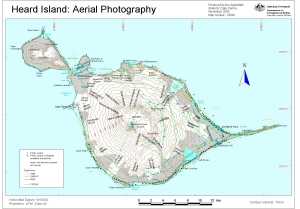
| Map Number | 13044 |
| Title | Heard Island: aerial photography |
| Edition | 1 |
| Scale | 1 : 170 000 |
| Publication date | November 2003 |
| Publisher |
Australian Antarctic Division (Australia)
|
| Spatial coverage |
( 73.1667° -52.9000°)
,
( 73.9167° -52.9000°)
,
( 73.9167° -53.2500°)
( 73.1667° -53.2500°) |
| Projection | Universal Transverse Mercator |
| Physical size | 21 x 29.7 cm A4 |
| Keywords | Heard Island , Aerial Photography , Azorella Peninsula , Laurens Peninsula , Spit Point , Compton Glacier , Big Ben , Mawson Peak , Gotley Glacier , Fiftyone Glacier |
Downloads
This is a digital map available for downloading.
Map Lists
This map belongs to the following lists. Use the link on the list to see all maps belonging to that list
Additional Information
| Horizontal datum | WGS84 |
| Nomenclature | Australian Antarctic Names Gazetteer |
Preview