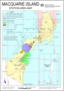
Map 13055: Macquarie Island Station Area Map
Map details
| Map Number | 13055 |
| Title | Macquarie Island Station Area Map |
| Edition | 4 |
| Previous edition | [Previous edition : 3] |
| Scale | 1 : 7500 |
| Publication date | March 2004 |
| Publisher |
Australian Antarctic Division (Australia)
|
| Spatial coverage |
(158.9258° -54.4931°)
,
(158.9472° -54.4931°)
,
(158.9472° -54.5083°)
(158.9258° -54.5083°) |
| Projection | Universal Transverse Mercator |
| Physical size | 29.7 x 21 cm A4 |
| Notes |
This map is out of date. See Macquarie Island map list for a current map of Macquarie Island station. |
| Keywords | Macquarie Island Station |
Downloads
This is a digital map available for downloading.
Map Lists
No maps lists available.
Additional Information
| Horizontal datum | WGS84 |
| Vertical datum | Mean sea level |
| Nomenclature | Doctor's Track and Tractor Rock are unofficial names. Names of other geographic features have been approved by the Nomenclature Board of Tasmania. |
Preview