Map 13060: Australia to Antarctica
Map details
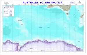
| Map Number | 13060 |
| Title | Australia to Antarctica |
| Edition | 2 |
| Previous edition | [Previous edition : 1] |
| Scale | 1 : 8 500 000 |
| Publication date | January 2004 |
| Publisher | - |
| Spatial coverage |
( 45.0000° -31.0000°)
,
(172.0000° -31.0000°)
,
(172.0000° -72.0000°)
( 45.0000° -72.0000°) |
| Projection | Mercator |
| Physical size | 71 x 114 cm |
| Keywords | Australian Antarctic Territory , Iles Kerguelen , Subantarctic Front , Polar Front , Macquarie Island , Heard Island , Balleny Islands , Magnetic South Pole , Campbell Island , Auckland Island , Topographic |
Downloads
This is a digital map available for downloading.
Map Lists
This map belongs to the following lists. Use the link on the list to see all maps belonging to that list
Additional Information
| Nomenclature | Names within the Australian Antarctic Territory and Heard Island are from the Australian Antarctic Gazetteer |
Preview