Australia to Antarctica
View All Map ListsMaps showing part or whole of Antarctica in relation to Australia
Showing 1 to 20 of 24 maps. On page 1 of 2, go to the Next Page
Australia and New Zealand to the Ross Sea View Map Details
Map ID - 14045
Published On - May-2012 Scale - 1 : 18 000 000 Physical Size- 29.7 x 21 cm A4 
|
Australia and the Australian Antarctic Territory View Map Details
Map ID - 14603
Published On - July-2017 Scale - 1 : 38 900 000 Physical Size- 30.5 x 21 cm 
|
Australia to Antarctica View Map Details
Map ID - 13060
Published On - January-2004 Scale - 1 : 8 500 000 Physical Size- 71 x 114 cm 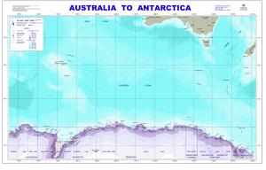
|
Australia to Antarctica showing the locations of Australia's year-round stations View Map Details
Map ID - 13985
Published On - August-2011 Scale - 1 : 37 000 000 Physical Size- 14.8 x 21 cm 
|
Australia to Antarctica showing the locations of Australia's year-round stations View Map Details
Map ID - 14025
Published On - April-2012 Scale - 1 : 40 000 000 Physical Size- 9.1 x 16.5 cm 
|
Australia to Antarctica: administrative boundaries and physical features View Map Details
Map ID - 13435
Published On - November-2007 Scale - 1 : 31 000 000 Physical Size- - 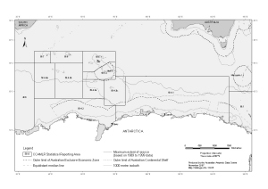
|
Australia to the Australian Antarctic Territory - Plot your route View Map Details
Map ID - 12145
Published On - July-2000 Scale - Not Entered Physical Size- 21 x 29.7 cm A4 
|
Australian Antarctic Program : 2011/12 Voyage Season (Aurora Australis) View Map Details
Map ID - 14030
Published On - May-2012 Scale - 1 : 30 000 000 Physical Size- 29.7 x 42 cm A3 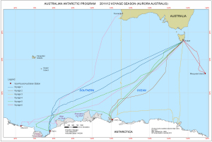
|
Australian Antarctic Program : 2012/13 Voyage Season View Map Details
Map ID - 14212
Published On - April-2013 Scale - 1 : 18 000 000 Physical Size- 29.7 x 42 cm A3 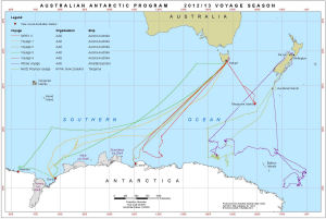
|
Australian Antarctic Program : 2013/14 Voyage Season View Map Details
Map ID - 14291
Published On - May-2014 Scale - 1 : 18 000 000 Physical Size- 29.7 x 42 cm A3 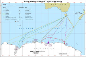
|
Base map of Australia to Antarctica View Map Details
Map ID - 13746
Published On - February-2010 Scale - 1 : 49 000 000 Physical Size- 21.5 x 12 cm 
|
Base map of Australia to Antarctica View Map Details
Map ID - 13233
Published On - January-2006 Scale - 1 : 38 000 000 Physical Size- 21.5 x 12.2 cm 
|
Great circle distances to and within East Antarctica (kilometres) View Map Details
Map ID - 12133
Published On - July-2000 Scale - 1 : 27 000 000 Physical Size- 42 x 29.7 cm A3 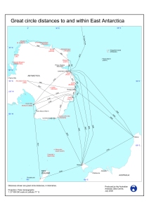
|
Great circle distances to and within East Antarctica (nautical miles) View Map Details
Map ID - 11105
Published On - June-1999 Scale - 1 : 27 000 000 Physical Size- 29.7 x 21 cm 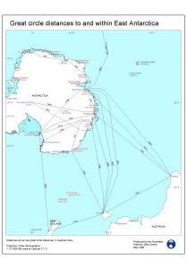
|
Heard Island and McDonald Islands Bathymetry and Features View Map Details
Map ID - 16160
Published On - 2024 Scale - 1 : 5 000 000 Physical Size- 21 x 29.7 cm A4 Vertical Unit - Meters 
|
Heard Island and McDonald Islands in relation to Australia and Antarctica View Map Details
Map ID - 13576
Published On - December-2008 Scale - 1 : 37 000 000 Physical Size- 14.8 x 21 cm 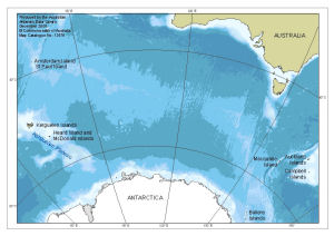
|
Location of Davis View Map Details
Map ID - 14359
Published On - March-2015 Scale - 1 : 26 000 000 Physical Size- 21 x 29.7 cm A4 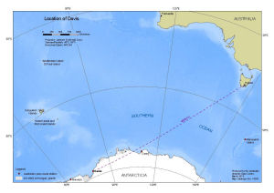
|
Location of Heard Island and McDonald Islands View Map Details
Map ID - 14237
Published On - July-2013 Scale - 1 : 26 000 000 Physical Size- 21 x 29.7 cm A4 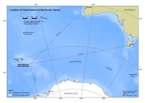
|
Location of Heard Island and McDonald Islands (with EEZ) View Map Details
Map ID - 16159
Published On - February-2024 Scale - 1 : 26 000 000 Physical Size- 21 x 29.7 cm A4 
|
Macquarie Island in relation to Australia and Antarctica View Map Details
Map ID - 14536
Published On - September-2016 Scale - 1 : 37 000 000 Physical Size- 14.8 x 21 cm 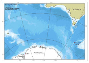
|
Showing 1 to 20 of 24 maps. On page 1 of 2, go to the Next Page