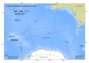
Map 14237: Location of Heard Island and McDonald Islands
Map details
| Map Number | 14237 |
| Title | Location of Heard Island and McDonald Islands |
| Edition | 1 |
| Scale | 1 : 26 000 000 |
| Publication date | July 2013 |
| Publisher |
Australian Antarctic Division (Australia)
|
| Spatial coverage |
( 55.0000° -30.0000°)
,
(170.0000° -30.0000°)
,
(170.0000° -70.0000°)
( 55.0000° -70.0000°) |
| Projection | Lambert Conformal Conic |
| Physical size | 21 x 29.7 cm A4 |
| Notes |
This map was produced for the Heard Island and McDonald Islands Marine Reserve Management Plan 2014-24. The coastline of Antarctica is from the Antarctic Digital Database version 6 © 1993-2015 Scientific Committee on Antarctic Research and the bathymetry is from the GEBCO_08 Grid, version 20091120. |
| Keywords | Heard , Mawson , Fremantle , Hobart |
Downloads
This is a digital map available for downloading.
Map Lists
This map belongs to the following lists. Use the link on the list to see all maps belonging to that list
Additional Information
| Horizontal datum | WGS84 |
Preview