Map 14030: Australian Antarctic Program : 2011/12 Voyage Season (Aurora Australis)
Map details
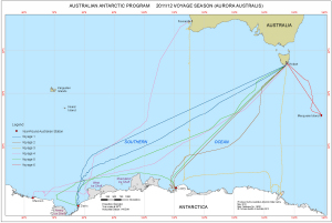
| Map Number | 14030 |
| Title | Australian Antarctic Program : 2011/12 Voyage Season (Aurora Australis) |
| Edition | 1 |
| Scale | 1 : 30 000 000 |
| Publication date | May 2012 |
| Publisher |
Australian Antarctic Division (Australia)
|
| Spatial coverage |
( 54.0000° -30.0000°)
,
(161.0000° -30.0000°)
,
(161.0000° -70.0000°)
( 54.0000° -70.0000°) |
| Projection | Mercator |
| Physical size | 29.7 x 42 cm A3 |
| Notes | This map was produced for inclusion in Volume 1: Sea Ice Reports for the Season 2011/12 published by the Antarctic Climate & Ecosystems Cooperative Research Centre. |
| Keywords | Aurora Australis , 2011-12 , 2011/2012 , 2011-2012 , Voyages , Track , Ship Tracks |
Downloads
This is a digital map available for downloading.
Map Lists
This map belongs to the following lists. Use the link on the list to see all maps belonging to that list
Additional Information
| Horizontal datum | WGS84 |
Preview