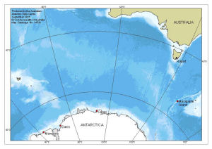
Map 14536: Macquarie Island in relation to Australia and Antarctica
Map details
| Map Number | 14536 |
| Title | Macquarie Island in relation to Australia and Antarctica |
| Edition | 1 |
| Scale | 1 : 37 000 000 |
| Publication date | September 2016 |
| Publisher |
Australian Antarctic Division (Australia)
|
| Spatial coverage |
( 50.0000° -33.0000°)
,
(180.0000° -33.0000°)
,
(180.0000° -70.0000°)
( 50.0000° -70.0000°) |
| Projection | Azimuthal Equidistant |
| Physical size | 14.8 x 21 cm |
| Notes |
The bathymetry is from the General Bathymetric Chart of the Oceans (GEBCO) 2014 Grid, version 20150318. The Antarctic coastline is from the Antarctic Digital Database version 6. |
| Keywords | Macquarie , Casey , Davis , Mawson , Topographic |
Downloads
This is a digital map available for downloading.
Map Lists
This map belongs to the following lists. Use the link on the list to see all maps belonging to that list
Additional Information
| Horizontal datum | WGS84 |
Preview