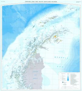
Map 13237: Graham Land and South Shetland Islands
Map details
| Map Number | 13237 |
| Title | Graham Land and South Shetland Islands |
| Edition | 1 (Out of Date) |
| Next Edition | [Next Edition : 3] |
| Scale | 1 : 1 000 000 |
| Publication date | 2005 |
| Publisher |
British Antarctic Survey, Cambridge (United Kingdom)
|
| Spatial coverage |
( -71.3333° -60.8333°)
,
( -52.0000° -60.8333°)
,
( -52.0000° -69.0000°)
( -71.3333° -69.0000°) |
| Projection | Polar Stereographic |
| Physical size | 98 x 88.5 cm |
| Notes | BAS Miscellanesous series. Sheet BAS(Misc) 13B. Double sided - See Mapcat ref. 13236 BAS(Misc) 13A. Map compiled by A. Cziferszky. ISBN: 1 85531 303 0 |
| Reference | BAS(Misc) 13B |
| Keywords | Graham Land , South Shetland Islands , Larsen Ice Shelf , Marguerite Bay , Adelaide Island , Anvers Island , Biscoe Islands , Bas(Misc) 13B , Topographic |
Downloads
No downloads available.
This is a hard copy map. See information about obtaining copies of hard copy maps.
Map Lists
No maps lists available.
Additional Information
| Horizontal datum | WGS84 |
Preview