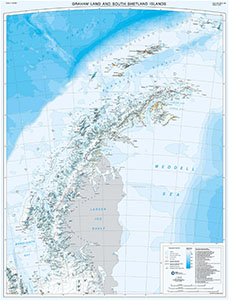
Map 15294: Graham Land and South Shetland Islands
Map details
| Map Number | 15294 |
| Title | Graham Land and South Shetland Islands |
| Edition | 3 |
| Previous edition | [Previous edition : 1] |
| Scale | 1 : 1 000 000 |
| Publication date | 2016 |
| Publisher |
British Antarctic Survey, Cambridge (United Kingdom)
|
| Spatial coverage |
( -68.0000° -60.8333°)
,
( -52.0000° -60.8333°)
,
( -52.0000° -69.7500°)
( -68.0000° -69.7500°) |
| Projection | Polar Stereographic |
| Physical size | 110 x 84 cm |
| Notes | This is side B of a double-sided map. A map of 'Antarctic Peninsula and Weddell Sea' (Map Number 15293) is on the reverse. More information can be found at https://www.bas.ac.uk/data/our-data/maps/topographic-maps/antarctic-peninsula-and-weddell-sea-graham-land-and-south-shetland-islands/ |
| Reference | BAS (Misc) 13B |
| Keywords | Antarctic Peninsula , Graham Land , South Shetland Islands , Larsen Ice Shelf , Marguerite Bay , Adelaide Island , Topographic |
Downloads
No downloads available.
Map Lists
This map belongs to the following lists. Use the link on the list to see all maps belonging to that list
Additional Information
| Horizontal datum | WGS84 |
| Vertical unit | Metres |
| Nomenclature | UK Antarctic Place-names gazetteer |
Preview