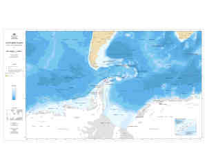
Map 13276: Southern Ocean : 30°S to 80°S Western Sheet
Map details
| Map Number | 13276 |
| Title | Southern Ocean : 30°S to 80°S Western Sheet |
| Edition | 1 |
| Scale | 1 : 12 000 000 |
| Publication date | August 2006 |
| Publisher |
Australian Antarctic Division (Australia)
|
| Spatial coverage |
(-140.0000° -30.0000°)
,
( 40.0000° -30.0000°)
,
( 40.0000° -80.0000°)
(-140.0000° -80.0000°) |
| Projection | Mercator |
| Physical size | 84.1 x 118.9 cm |
| Notes |
Inset: Antarctic Peninsula stations - South Shetland Islands The bathymetric data is from "Centenary Edition of the GEBCO Digital Atlas", 2003, published on behalf of the Intergovernmental Oceanographic Commission and the International Hydrographic Organization as part of the General Bathymetric Chart of the Oceans; British Oceanographic Data Centre, Liverpool. The antarctic coastline data is from the Antarctic Digital Database version 4.0 © Scientific Committee on Antarctic Research 1993-2006. The ocean fronts data is data described in Orsi, A. H., Whitworth III, T., and Nowlin, W. D. (1995), On the meridional extent and fronts of the Antarctic Circumpolar Current. Deep-Sea Research I, 42(5), 641-673. |
| Keywords | Southern Ocean , Antarctic Circumpolar Current , Subantarctic Front , Polar Front , Subtropical Front , Amundsen Abyssal Plain , Bellingshausen Abyssal Plain , Weddell Abyssal Plain , Amundsen Ridge. Marie Byrd Seamount , Lazarev Sea , Riiser-Larsen Sea , Bathymetry |
Downloads
This is a digital map available for downloading.
Map Lists
This map belongs to the following lists. Use the link on the list to see all maps belonging to that list
Additional Information
| Horizontal datum | WGS84 |
Preview