Map 13283: Australian Exclusive Economic Zone: Macquarie Island East
Map details
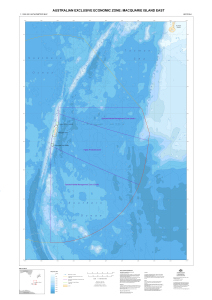
| Map Number | 13283 |
| Title | Australian Exclusive Economic Zone: Macquarie Island East |
| Edition | 1 |
| Scale | 1 : 1 000 000 |
| Publication date | July 2006 |
| Publisher | - |
| Spatial coverage |
(157.0000° -50.5000°)
,
(167.0000° -50.5000°)
,
(167.0000° -59.0000°)
(157.0000° -59.0000°) |
| Projection | Mercator |
| Physical size | 118.8 x 82 cm |
| Notes |
This map covers the eastern part of the Australian Exclusive Economic Zone around Macquarie Island. Map 13282 covers the western part. |
| Keywords | Bathymetry , Exclusive Economic Zone , Macquarie Island , Marine Park , Bathymetry |
Downloads
This is a digital map available for downloading.
Map Lists
This map belongs to the following lists. Use the link on the list to see all maps belonging to that list
Additional Information
| Horizontal datum | WGS 84 |
| Vertical datum | Mean Sea Level |
Preview