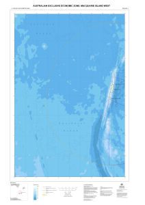
Map 13302: Australian Exclusive Economic Zone: Macquarie Island West
Map details
| Map Number | 13302 |
| Title | Australian Exclusive Economic Zone: Macquarie Island West |
| Edition | 1 |
| Scale | 1 : 1 000 000 |
| Publication date | August 2006 |
| Publisher | - |
| Spatial coverage |
(150.0000° -50.5000°)
,
(160.0000° -50.5000°)
,
(160.0000° -59.0000°)
(150.0000° -59.0000°) |
| Projection | Mercator |
| Physical size | 118.8 x 82 cm |
| Notes |
This map and map 13282 cover the western part of the Australian Exclusive Economic Zone around Macquarie Island. Map 13282 extends from 147 degrees East to 157 degrees East. Map 13283 covers the eastern part of the Exclusive Economic Zone. |
| Keywords | Bathymetry , Exclusive Economic Zone , Macquarie Island , Bathymetry |
Downloads
This is a digital map available for downloading.
Map Lists
This map belongs to the following lists. Use the link on the list to see all maps belonging to that list
Additional Information
| Horizontal datum | WGS 84 |
| Vertical datum | Mean Sea Level |
Preview