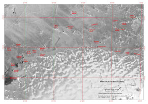
Map 13458: Mawson to Auster Rookery
Map details
| Map Number | 13458 |
| Title | Mawson to Auster Rookery |
| Edition | 1 |
| Scale | 1 : 130 000 |
| Publication date | January 2008 |
| Publisher |
Australian Antarctic Division (Australia)
|
| Spatial coverage |
( 62.8250° -67.3556°)
,
( 64.0256° -67.3556°)
,
( 64.0256° -67.6725°)
( 62.8250° -67.6725°) |
| Projection | Universal Transverse Mercator |
| Physical size | 29.7 x 42 cm A3 |
| Keywords | Douglas Islands , Child Rocks , Anderson Island , Thorgaut Island , Macey Islands , Auster Rookery , Auster Islands , Robinson Group , Macklin Island , Kirton Island , Cape Daly , Safety Island , Austskjera , Sawert Rocks , Hansen Rocks , Canopus Islands , Klung Islands , Smith Rocks , Kitney Island , Wiltshire Rocks , Paterson Islands , Welch Island , Jocelyn Islands , Satellite Imagery |
Downloads
This is a digital map available for downloading.
Map Lists
This map belongs to the following lists. Use the link on the list to see all maps belonging to that list
Additional Information
| Horizontal datum | WGS84 |
| Nomenclature | Australian Antarctic Gazetteer |
Preview