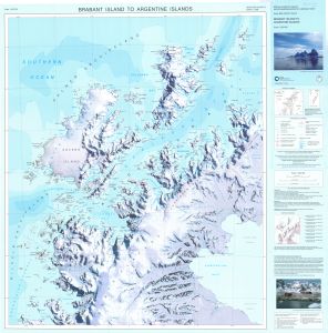
Map 13489: Brabant Island to Argentine Islands
Map details
| Map Number | 13489 |
| Title | Brabant Island to Argentine Islands |
| Edition | 1 (Out of Date) |
| Next Edition | [Next Edition : 2] |
| Scale | 1 : 250 000 |
| Publication date | 2008 |
| Publisher |
British Antarctic Survey, Cambridge (United Kingdom)
|
| Spatial coverage |
( -65.0000° -63.7500°)
,
( -61.1333° -63.7500°)
,
( -61.1333° -65.8333°)
( -65.0000° -65.8333°) |
| Projection | Lambert Conformal Conic |
| Physical size | 86.5 x 86.5 cm |
| Notes |
Compiled by M. Biszczuk and A. Cook ISBN: 978 1 85531 311 8 |
| Reference | BAS(UKAHT)2 |
| Keywords | Brabant Island , Argentine Islands , Bruce Plateau , Forbidden Plateau , Exasperation Inlet , Anvers Island , Grandidier Channel , Flandres Bay , Andvord Bay , Wilhelmina Bay , Gerlache Strait , Wiencke Island , Wauvermans Islands , Dallmann Bay , Ukaht , United Kingdom Antarctic Heritage Trust , Bouquet Bay , Hughes Bay , Croker Passage , Survey Marks , Topographic |
Downloads
No downloads available.
Map Lists
No maps lists available.
Additional Information
| Horizontal datum | WGS84 |
Preview