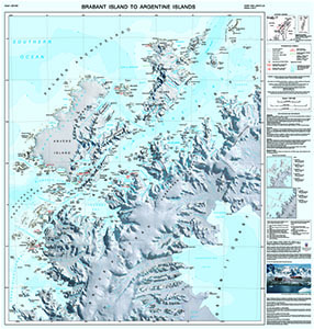
Map 15295: Brabant Island to Argentine Islands
Map details
| Map Number | 15295 |
| Title | Brabant Island to Argentine Islands |
| Edition | 2 |
| Previous edition | [Previous edition : 1] |
| Scale | 1 : 250 000 |
| Publication date | 2017 |
| Publisher |
British Antarctic Survey, Cambridge (United Kingdom)
|
| Spatial coverage |
( -64.5000° -63.7500°)
,
( -61.0000° -63.7500°)
,
( -61.0000° -65.7500°)
( -64.5000° -65.7500°) |
| Projection | Lambert Conformal Conic |
| Physical size | 88 x 84 cm |
| Notes | This is side A of a double-sided map. A map of 'Argentine Islands to Adelaide Island' (Map number 15296) is on the reverse. More information can be found at https://www.bas.ac.uk/data/our-data/maps/topographic-maps/brabant-island-to-adelaide-island/ |
| Reference | BAS (UKAHT) 2A |
| Keywords | Brabant Island , Anvers Island , Argentine Islands , Gerlache Strait , UKAHT , Port Lockroy |
Downloads
No downloads available.
Map Lists
This map belongs to the following lists. Use the link on the list to see all maps belonging to that list
Additional Information
| Horizontal datum | WGS84 |
| Vertical unit | Metres |
| Nomenclature | UK Antarctic Place-names gazetteer |
Preview