Map 13521: Geology of the Stillwell Hills
Map details
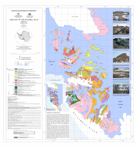
| Map Number | 13521 |
| Title | Geology of the Stillwell Hills |
| Edition | 1 |
| Scale | 1 : 25 000 |
| Publication date | April 2012 |
| Publisher |
Australian Antarctic Division (Australia)
Geoscience Australia (Australia) |
| Spatial coverage |
( 59.3072° -67.2931°)
,
( 59.6131° -67.2931°)
,
( 59.6131° -67.4781°)
( 59.3072° -67.4781°) |
| Projection | Universal Transverse Mercator |
| Physical size | 83.5 x 79.9 cm |
| Notes |
Compiled by J.A. Halpin Includes references. |
| Reference | GeoCat 72717 |
| Keywords | Fold Island , Ledingham's Depot , Stefansson Bay , Dovers Glacier , Stillwell Lake , William Scoresby Bay , Keel Island , Transverse Island , Geocat 72717 , Geology |
Downloads
This is a digital map available for downloading.
Map Lists
This map belongs to the following lists. Use the link on the list to see all maps belonging to that list
Additional Information
| Horizontal datum | WGS84 |
| Vertical datum | msl |
| Nomenclature | Australian Antarctic Gazetteer |
Preview