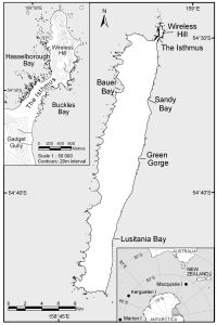
Map 13529: Macquarie Island with insets of "The Isthmus and Wireless Hill" and "Macquarie Island in relation to Australia and Antarctica" [Black and white]
Map details
| Map Number | 13529 |
| Title | Macquarie Island with insets of "The Isthmus and Wireless Hill" and "Macquarie Island in relation to Australia and Antarctica" [Black and white] |
| Edition | 1 |
| Scale | 1 : 333 000 |
| Publication date | October 2008 |
| Publisher |
Australian Antarctic Division (Australia)
|
| Spatial coverage |
(158.6497° -54.4619°)
,
(159.0386° -54.4619°)
,
(159.0386° -54.8053°)
(158.6497° -54.8053°) |
| Projection | Universal Transverse Mercator |
| Physical size | 11.8 x 7.8 cm |
| Notes | Includes insets of The Isthmus and Wireless Hill and Macquarie Island in relation to Australia and Antarctica |
| Keywords | Macquarie Island , Wireless Hill , The Isthmus , Hasselborough Bay , Buckles Bay , Gadget Gully , Bauer Bay , Sandy Bay , Green Gorge , Lusitania Bay , Topographic |
Downloads
This is a digital map available for downloading.
Map Lists
This map belongs to the following lists. Use the link on the list to see all maps belonging to that list
Additional Information
| Horizontal datum | WGS84 |
| Nomenclature | Australian Antarctic Gazetteer |
Preview