Black and white maps for publications
View All Map ListsBlack and white maps of suitable size and general nature for publications
Showing 1 to 20 of 36 maps. On page 1 of 2, go to the Next Page
Amery Ice Shelf to Vestfold Hills [Black and white] View Map Details
Map ID - 14068
Published On - July-2012 Scale - 1 : 2 000 000 Physical Size- 10 x 12.9 cm ![Amery Ice Shelf to Vestfold Hills [Black and white]](/database/mapcat/ingrid_christ_coast/amery_to_vestfold_bw_14068_thumb.jpg)
|
Antarctic Peninsula and Southern Tip of South America View Map Details
Map ID - 13636
Published On - May-2009 Scale - 1 : 21 500 000 Physical Size- 12 x 17 cm 
|
Antarctic Peninsula and Southern Tip of South America (Livingston Island labeled) View Map Details
Map ID - 13669
Published On - June-2009 Scale - 1 : 21 500 000 Physical Size- 12 x 17 cm 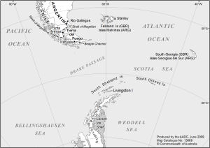
|
Antarctica and the Southern Ocean
|
Antarctica [Black and white A4] View Map Details
Map ID - 13154
Published On - June-2005 Scale - 1 : 34 970 000 Physical Size- - ![Antarctica [Black and white A4]](/database/mapcat/antarctica/antarctica_b&w_A4_thumb.jpg)
|
Antarctica [Black and white] View Map Details
Map ID - 13202
Published On - November-2005 Scale - 1 : 64 021 800 Physical Size- 10.3 x 10.3 cm ![Antarctica [Black and white]](/database/mapcat/antarctica/ant_b&w_13202_thumb.jpg)
|
Antarctica [Black and white] View Map Details
Map ID - 13117
Published On - November-2004 Scale - 1 : 60 140 000 Physical Size- 11.4 x 11.1 cm ![Antarctica [Black and white]](/database/mapcat/antarctica/antarctica_b&w_thumb.jpg)
|
Antarctica and the Southern Ocean [Black and white] View Map Details
Map ID - 14289
Published On - May-2014 Scale - 1 : 116 000 000 Physical Size- 8.5 x 8.5 cm ![Antarctica and the Southern Ocean [Black and white]](/database/mapcat/sthn_ocean/antarctica_sthn_ocean_bw_14289_thumb.jpg)
|
Antarctica on top [Black and white A4] View Map Details
Map ID - 13572
Published On - November-2008 Scale - 1 : 48 000 000 Physical Size- 21 x 29.7 cm A4 ![Antarctica on top [Black and white A4]](/database/mapcat/sthn_hemisphere/antarctica_on_top_bw_13572_thumb.jpg)
|
Antarctica with hill shading [Black and white] View Map Details
Map ID - 13469
Published On - April-2008 Scale - 1 : c59 259 900 Physical Size- 9.7 x 10 cm ![Antarctica with hill shading [Black and white]](/database/mapcat/antarctica/13469_antarctica_map_bw_thumb.jpg)
|
Antarctica: Territorial Claims [Black and white] View Map Details
Map ID - 13567
Published On - November-2008 Scale - 1 : 70 000 000 Physical Size- 10.5 x 10.5 cm ![Antarctica: Territorial Claims [Black and white]](/database/mapcat/antarctica/territorial_claims_b&w_13567_thumb.jpg)
|
Cape Denison to Cook Ice Shelf [Black and white] View Map Details
Map ID - 14124
Published On - July-2012 Scale - 1 : 3 500 000 Physical Size- 12 x 15 cm ![Cape Denison to Cook Ice Shelf [Black and white]](/database/mapcat/george_v_land/cape_denison_cook_ice_shelf_14124_thumb.jpg)
|
Clark and Bailey Peninsulas, Windmill Islands [Black and white] View Map Details
Map ID - 13736
Published On - November-2009 Scale - 1 : 100 000 Physical Size- 8 x 8.9 cm ![Clark and Bailey Peninsulas, Windmill Islands [Black and white]](/database/mapcat/windmill/clark_bailey_peninsulas_bw_13736_thumb.jpg)
|
Clark Peninsula to O'Brien Bay, Windmill Islands with Casey inset [Black and white] View Map Details
Map ID - 14288
Published On - April-2014 Scale - 1 : 85 000 Physical Size- 12.2 x 17.7 cm ![Clark Peninsula to O'Brien Bay, Windmill Islands with Casey inset [Black and white]](/database/mapcat/windmill/clark_peninsula_to_obrien_bay_14288_thumb.jpg)
|
Davis with Vestfold Hills and Antarctica insets [Black and white] View Map Details
Map ID - 14119
Published On - August-2012 Scale - 1 : 14 000 Physical Size- 14.2 x 20.4 cm ![Davis with Vestfold Hills and Antarctica insets [Black and white]](/database/mapcat/davis/davis_bw_14119_thumb.jpg)
|
East Antarctica [Black and white] View Map Details
Map ID - 13735
Published On - November-2009 Scale - 1 : 55 000 000 Physical Size- 8.9 x 8.9 cm ![East Antarctica [Black and white]](/database/mapcat/antarctica_east/east_antarctica_b&w_13735_thumb.jpg)
|
Gaussberg to Shackleton Ice Shelf [Black and white] View Map Details
Map ID - 14125
Published On - July-2012 Scale - 1 : 4 000 000 Physical Size- 12 x 15 cm ![Gaussberg to Shackleton Ice Shelf [Black and white]](/database/mapcat/gaussberg/gaussberg_shackleton_ice_shelf_14125_thumb.jpg)
|
Heard Island [Black and white] View Map Details
Map ID - 13138
Published On - May-2005 Scale - 1 : 853 600 Physical Size- 4 x 5.5 cm ![Heard Island [Black and white]](/database/mapcat/heard/heard_island_bw_thumb.jpg)
|
Heard Island and Macquarie Island in relation to Australia and Antarctica [Black and white] View Map Details
Map ID - 13994
Published On - September-2011 Scale - 1 : 122 830 256 Physical Size- 3.7 x 4.7 cm ![Heard Island and Macquarie Island in relation to Australia and Antarctica [Black and white]](/database/mapcat/heard/heard_location_ps_bw_13994_thumb.jpg)
|
Heard Island in relation to Australia and Antarctica [Black and white] View Map Details
Map ID - 13134
Published On - March-2005 Scale - 1 : 132 100 000 Physical Size- 3.7 x 4.7 cm ![Heard Island in relation to Australia and Antarctica [Black and white]](https://data.aad.gov.au/database/mapcat/heard/heard_australia_antarctica_thumb.jpg)
|
![Antarctica and the Southern Ocean<br>
including year-round Australian stations [Black and white]](/database/mapcat/sthn_ocean/antarctica_ps_14159_thumb.jpg)
Showing 1 to 20 of 36 maps. On page 1 of 2, go to the Next Page