Black and white maps for publications
View All Map ListsBlack and white maps of suitable size and general nature for publications
Showing 21 to 36 of 36 maps. On page 2 of 2, go to the Previous Page
Holme Bay [Black and white] View Map Details
Map ID - 13139
Published On - May-2005 Scale - 1 : 261 300 Physical Size- 6 x 10 cm ![Holme Bay [Black and white]](/database/mapcat/holme/holme_bay_bw_thumb.jpg)
|
Holme Bay with Antarctic inset [Black and white] View Map Details
Map ID - 13155
Published On - June-2005 Scale - 1 : 261 300 Physical Size- 6 x 10 cm ![Holme Bay with Antarctic inset [Black and white]](/database/mapcat/holme/holme_bay_bw_with_ant_inset_thumb.jpg)
|
Location of Macquarie Island in relation to Australia and Antarctica [Black and white] View Map Details
Map ID - 13143
Published On - May-2005 Scale - 1 : c139 928 200 Physical Size- 4.5 x 5.5 cm ![Location of Macquarie Island in relation to Australia and Antarctica [Black and white]](/database/mapcat/maccais/macca_location_bw_thumb.jpg)
|
Macquarie Island [Black and white A4] View Map Details
Map ID - 13265
Published On - April-2006 Scale - 1 : 150 000 Physical Size- 29.7 x 21 cm A4 ![Macquarie Island [Black and white A4]](/database/mapcat/maccais/macca_A4_bw_13265_thumb.jpg)
|
Macquarie Island [Black and white] View Map Details
Map ID - 13141
Published On - May-2005 Scale - 1 : c661 160 Physical Size- 5.7 x 3.8 cm ![Macquarie Island [Black and white]](/database/mapcat/maccais/macca_island_bw_thumb.jpg)
|
Macquarie Island with insets of "The Isthmus and Wireless Hill" and "Macquarie Island in relation to Australia and Antarctica" [Black and white] View Map Details
Map ID - 13529
Published On - October-2008 Scale - 1 : 333 000 Physical Size- 11.8 x 7.8 cm 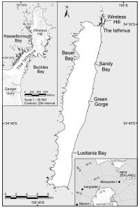
|
Mawson Coast [Black and white] View Map Details
Map ID - 13156
Published On - June-2005 Scale - 1 : 416 724 Physical Size- 11.9 x 19.4 cm ![Mawson Coast [Black and white]](/database/mapcat/mawson_coast/mawson_coast_bw_A5_thumb.jpg)
|
Scullin and Murray Monoliths [Black and white] View Map Details
Map ID - 14115
Published On - July-2012 Scale - 1 : 38 000 Physical Size- 20 x 8.2 cm ![Scullin and Murray Monoliths [Black and white]](/database/mapcat/scullin_murray/scullin_murray_bw_14115_thumb.jpg)
|
Southern Vestfold Hills [Black and white] View Map Details
Map ID - 13737
Published On - November-2009 Scale - 1 : 280 000 Physical Size- 8 x 8.9 cm ![Southern Vestfold Hills [Black and white]](/database/mapcat/vestfold/vestfold_hills_south_bw_13737_thumb.jpg)
|
Subantarctic islands [Black and white] View Map Details
Map ID - 13137
Published On - April-2005 Scale - 1 : 234 190 300 Physical Size- 5.4 x 5.3 cm ![Subantarctic islands [Black and white]](https://data.aad.gov.au/database/mapcat/sthn_ocean/subantarctic_islands_thumb.jpg)
|
The Isthmus at Macquarie Island
|
Vestfold Hills [Black and white] View Map Details
Map ID - 13142
Published On - May-2005 Scale - 1 : 421 813 Physical Size- 9.2 x 7.5 cm ![Vestfold Hills [Black and white]](/database/mapcat/vestfold/vestfold_hills_bw_thumb.jpg)
|
Windmill Islands [Black and white] View Map Details
Map ID - 13140
Published On - May-2005 Scale - 1 : 760 000 Physical Size- 5.2 x 4.8 cm ![Windmill Islands [Black and white]](https://data.aad.gov.au/database/mapcat/windmill/windmill_Islands_bw_thumb.jpg)
|
Windmill Islands with Antarctica inset [Black and white] View Map Details
Map ID - 13629
Published On - March-2009 Scale - 1 : 230 000 Physical Size- 21 x 15 cm ![Windmill Islands with Antarctica inset [Black and white]](/database/mapcat/windmill/13629_thumb.jpg)
|
Windmill Islands with Antarctica inset [Black and white] View Map Details
Map ID - 14018
Published On - February-2012 Scale - 1 : 393 385 Physical Size- 10.6 x 8 cm ![Windmill Islands with Antarctica inset [Black and white]](/database/mapcat/windmill/windmill_bw_14018_thumb.jpg)
|
Year-round stations in Antarctica [Black and white] View Map Details
Map ID - 13392
Published On - May-2007 Scale - 1 : 33 000 000 Physical Size- 29.7 x 21 cm A4 ![Year-round stations in Antarctica [Black and white]](/database/mapcat/antarctica/antarctica_b&w_stations_13392_thumb.jpg)
|
![The Isthmus at Macquarie Island <br>
with a Macquarie Island inset and an inset showing the location of Macquarie Island in relation to Australia and New Zealand [Black and white]](/database/mapcat/maccastn/macquarie_isthmus_2insets_14216_thumb.jpg)
Showing 21 to 36 of 36 maps. On page 2 of 2, go to the Previous Page