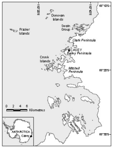
Map 14018: Windmill Islands with Antarctica inset [Black and white]
Map details
| Map Number | 14018 |
| Title | Windmill Islands with Antarctica inset [Black and white] |
| Edition | 1 |
| Scale | 1 : 393 385 |
| Publication date | February 2012 |
| Publisher |
Australian Antarctic Division (Australia)
|
| Spatial coverage |
(110.0958° -66.1564°)
,
(110.7958° -66.1564°)
,
(110.7958° -66.5275°)
(110.0958° -66.5275°) |
| Projection | Universal Transverse Mercator |
| Physical size | 10.6 x 8 cm |
| Keywords | Casey , Topographic |
Downloads
This is a digital map available for downloading.
Map Lists
This map belongs to the following lists. Use the link on the list to see all maps belonging to that list
Additional Information
| Horizontal datum | WGS84 |
| Nomenclature | Australian Antarctic Gazetteer |
Preview