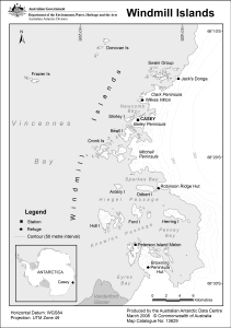
Map 13629: Windmill Islands with Antarctica inset [Black and white]
Map details
| Map Number | 13629 |
| Title | Windmill Islands with Antarctica inset [Black and white] |
| Edition | 1 |
| Scale | 1 : 230 000 |
| Publication date | March 2009 |
| Publisher | - |
| Spatial coverage |
(110.0000° -66.1667°)
,
(110.8333° -66.1667°)
,
(110.8333° -66.5333°)
(110.0000° -66.5333°) |
| Projection | Universal Transverse Mercator |
| Physical size | 21 x 15 cm |
| Keywords | Casey |
Downloads
This is a digital map available for downloading.
Map Lists
This map belongs to the following lists. Use the link on the list to see all maps belonging to that list
Additional Information
| Horizontal datum | WGS84 |
| Vertical datum | Mean Sea Level |
| Nomenclature | Australian Antarctic Gazetteer |
Preview