Map 13737: Southern Vestfold Hills [Black and white]
Map details
| Map Number | 13737 |
| Title | Southern Vestfold Hills [Black and white] |
| Edition | 1 |
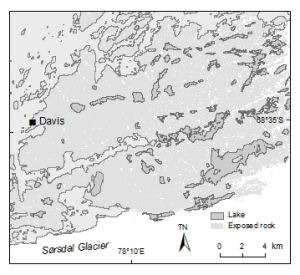
| Scale | 1 : 280 000 |
| Publication date | November 2009 |
| Publisher |
Australian Antarctic Division (Australia)
|
| Spatial coverage |
( 77.9172° -68.4928°)
,
( 78.5244° -68.4928°)
,
( 78.5244° -68.6922°)
( 77.9172° -68.6922°) |
| Projection | Universal Transverse Mercator |
| Physical size | 8 x 8.9 cm |
| Keywords | - |
Downloads
This is a digital map available for downloading.
Map Lists
This map belongs to the following lists. Use the link on the list to see all maps belonging to that list
Additional Information
| Horizontal datum | WGS84 |
| Nomenclature | The map only shows lakes with an area greater than 50000 square metres. |
Preview