Map 14068: Amery Ice Shelf to Vestfold Hills [Black and white]
Map details
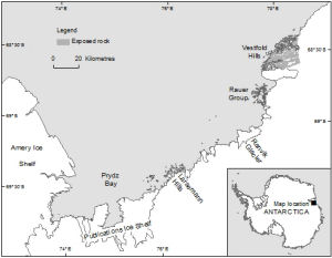
| Map Number | 14068 |
| Title | Amery Ice Shelf to Vestfold Hills [Black and white] |
| Edition | 1 |
| Scale | 1 : 2 000 000 |
| Publication date | July 2012 |
| Publisher |
Australian Antarctic Division (Australia)
|
| Spatial coverage |
( 72.7739° -68.2106°)
,
( 79.2508° -68.2106°)
,
( 79.2508° -70.0011°)
( 72.7739° -70.0011°) |
| Projection | Universal Transverse Mercator |
| Physical size | 10 x 12.9 cm |
| Keywords | Publications , Ranvik , Larsemann , Rauer , Topographic |
Downloads
This is a digital map available for downloading.
Map Lists
This map belongs to the following lists. Use the link on the list to see all maps belonging to that list
Additional Information
| Horizontal datum | WGS84 |
| Nomenclature | Australian Antarctic Gazetteer |
Preview