Map 14125: Gaussberg to Shackleton Ice Shelf [Black and white]
Map details
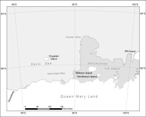
| Map Number | 14125 |
| Title | Gaussberg to Shackleton Ice Shelf [Black and white] |
| Edition | 1 |
| Scale | 1 : 4 000 000 |
| Publication date | July 2012 |
| Publisher |
Australian Antarctic Division (Australia)
|
| Spatial coverage |
( 88.9919° -63.9023°)
,
(100.8063° -63.9023°)
,
(100.8063° -67.6927°)
( 88.9919° -67.6927°) |
| Projection | Polar Stereographic |
| Physical size | 12 x 15 cm |
| Keywords | Davis Sea , Drygalski Island , Vetvistaja Bay , Tressler Bank , Masson Island , Henderson Island , Mill Island , Shackleton Ice Shelf , Gaussberg |
Downloads
This is a digital map available for downloading.
Map Lists
This map belongs to the following lists. Use the link on the list to see all maps belonging to that list
Additional Information
| Nomenclature | Australian Antarctic Gazetteer |
Preview