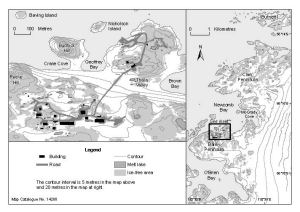
Map 14288: Clark Peninsula to O'Brien Bay, Windmill Islands with Casey inset [Black and white]
Map details
| Map Number | 14288 |
| Title | Clark Peninsula to O'Brien Bay, Windmill Islands with Casey inset [Black and white] |
| Edition | - |
| Scale | 1 : 85 000 |
| Publication date | April 2014 |
| Publisher |
Australian Antarctic Division (Australia)
|
| Spatial coverage |
(110.4914° -66.2217°)
,
(110.6156° -66.2217°)
,
(110.6156° -66.3144°)
(110.4914° -66.3144°) |
| Projection | Universal Transverse Mercator |
| Physical size | 12.2 x 17.7 cm |
| Notes | The scale of the Casey inset is 1:10000. |
| Keywords | Newcomb , Mcgrady , Burnett , Reeve , Budnick , Thala , Nicholson , Crane , Geoffrey , Brown , Topographic |
Downloads
Map Lists
This map belongs to the following lists. Use the link on the list to see all maps belonging to that list
Additional Information
| Horizontal datum | WGS84 |
| Vertical datum | Mean sea level |
| Nomenclature | Australian Antarctic Gazetteer |
Preview