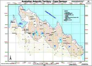
Map 13570: Australian Antarctic Territory - Cape Denison
Map details
| Map Number | 13570 |
| Title | Australian Antarctic Territory - Cape Denison |
| Edition | 2 (Out of Date) |
| Previous edition | [Previous edition : 1] |
| Next Edition | [Next Edition : 3] |
| Scale | 1 : 5000 |
| Publication date | November 2008 |
| Publisher | - |
| Spatial coverage |
(142.6528° -67.0042°)
,
(142.6911° -67.0042°)
,
(142.6911° -67.0144°)
(142.6528° -67.0144°) |
| Projection | Universal Transverse Mercator |
| Physical size | 32 x 43 cm A3 |
| Notes |
Topographic map compiled from detail survey by G.Crispo in December 1985. The Sorensen Hut, mapped from IKONOS satellite imagery captured in January 2001, was added in this edition. |
| Keywords | Cape Denison , Commonwealth Bay , Boat Harbour , Mawson's Hut , Sorensen Hut , Azimuth Hill , Memorial Hill , Beryl Hill , Penguin Knob , Petrel Hill , Survey Marks , Topographic |
Downloads
This is a digital map available for downloading.
Map Lists
This map belongs to the following lists. Use the link on the list to see all maps belonging to that list
Additional Information
| Horizontal datum | WGS84 |
| Vertical datum | Mean Sea Level |
| Nomenclature | Australian Antarctic Gazetteer |
Preview