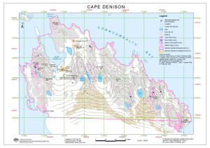
Map 13575: Cape Denison (OUT OF DATE)
Map details
| Map Number | 13575 |
| Title | Cape Denison (OUT OF DATE) |
| Edition | 3 |
| Previous edition | [Previous edition : 2] |
| Scale | 1 : 5000 |
| Publication date | April 2010 |
| Publisher | - |
| Spatial coverage |
(142.6528° -67.0042°)
,
(142.6911° -67.0042°)
,
(142.6911° -67.0144°)
(142.6528° -67.0144°) |
| Projection | Universal Transverse Mercator |
| Physical size | 29.7 x 42 cm A3 |
| Keywords | Cape Denison , Commonwealth Bay , Boat Harbour , Mawson's Hut , Sorensen Hut , Azimuth Hill , Memorial Hill , Beryl Hill , Penguin Knob , Petrel Hill , Survey Marks , Topographic |
Downloads
This is a digital map available for downloading.
Map Lists
This map belongs to the following lists. Use the link on the list to see all maps belonging to that list
- Cape Denison / Commonwealth Bay
- Oziexplorer maps
- Antarctic Specially Protected Areas and Antarctic Specially Managed Areas maps
Additional Information
| Horizontal datum | WGS84 |
| Vertical datum | Mean Sea Level |
| Nomenclature | Australian Antarctic Gazetteer |
Preview