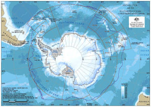
Map 13580: Antarctica and the Southern Ocean : CCAMLR statistical reporting subareas [A4]
Map details
| Map Number | 13580 |
| Title | Antarctica and the Southern Ocean : CCAMLR statistical reporting subareas [A4] |
| Edition | 1 |
| Scale | 1 : 44 000 000 |
| Publication date | March 2009 |
| Publisher | - |
| Spatial coverage |
(-180.0000° -30.0000°)
,
(180.0000° -30.0000°)
,
(180.0000° -90.0000°)
(-180.0000° -90.0000°) |
| Projection | Polar Stereographic |
| Physical size | 19.5 x 27.5 cm A4 |
| Notes |
Information about data used in this map can be obtained by searching using the following Dataset ids: Antarctic Polar Front: Dataset 33 Bathymetry: Dataset 186 (Qinfos 534, 535, 537 to 540) Antarctica: Dataset 134 CCAMLR Statistical Reporting Subareas: Dataset 206 (Qinfo 655) |
| Keywords | Polar Front |
Downloads
This is a digital map available for downloading.
Map Lists
This map belongs to the following lists. Use the link on the list to see all maps belonging to that list
Additional Information
Preview