Map 13721: Mill Island
Map details
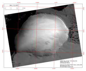
| Map Number | 13721 |
| Title | Mill Island |
| Edition | 1 |
| Scale | 1 : 280 000 |
| Publication date | October 2009 |
| Publisher |
Australian Antarctic Division (Australia)
|
| Spatial coverage |
(100.0761° -65.3097°)
,
(101.4989° -65.3097°)
,
(101.4989° -65.7814°)
(100.0761° -65.7814°) |
| Projection | Universal Transverse Mercator |
| Physical size | 21.3 x 25 cm |
| Keywords | Satellite Imagery |
Downloads
This is a digital map available for downloading.
Map Lists
This map belongs to the following lists. Use the link on the list to see all maps belonging to that list
Additional Information
| Horizontal datum | WGS84 |
Preview