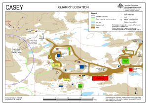
Map 13740: Casey Quarry Location
Map details
| Map Number | 13740 |
| Title | Casey Quarry Location |
| Edition | 2 |
| Previous edition | [Previous edition : 1] |
| Scale | 1 : 2000 |
| Publication date | January 2010 |
| Publisher |
Australian Antarctic Division (Australia)
|
| Spatial coverage |
(110.5110° -66.2780°)
,
(110.5330° -66.2780°)
,
(110.5330° -66.2830°)
(110.5110° -66.2830°) |
| Projection | Universal Transverse Mercator |
| Physical size | 21 x 29.7 cm A4 |
| Keywords | Casey , Station , Quarry , Snow Petrel , Nests , Topographic |
Downloads
This is a digital map available for downloading.
Map Lists
This map belongs to the following lists. Use the link on the list to see all maps belonging to that list
Additional Information
| Horizontal datum | WGS84 |
Preview