Asset Management maps
View All Map ListsMaps and plans produced for the Asset Management section of the Australian Antarctic Division
Showing 1 to 20 of 23 maps. On page 1 of 2, go to the Next Page
Annex B: Casey Station Spill Risk Assessment Map
|
Annex B: Davis Station Spill Risk Assessment Map
|
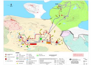
Annex B: Macquarie Island Spill Risk Assessment Map
|
Annex B: Mawson Station Spill Risk Assessment Map
|
Casey Asbestos Presence in Buildings View Map Details
Map ID - 15863
Published On - March-2023 Scale - 1 : 2500 Physical Size- 21 x 29.7 cm A4 Vertical Unit - Meters 
|
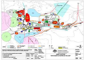
Casey Master Plan Issue No. 12 View Map Details
Map ID - 5148
Published On - September-1992 Scale - Not Entered Physical Size- 92 x 120 cm 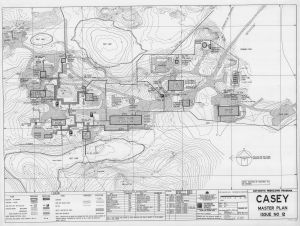
|
Casey Old Station Master Plan Issue No. 12 View Map Details
Map ID - 5146
Published On - September-1992 Scale - Not Entered Physical Size- 92 x 120 cm 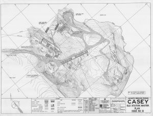
|
Casey quarry area with surveyed quarry boundary and outer limits set at 1985/86 showing positions of petrel nests current at 2004 and quarry face current at 2000 View Map Details
Map ID - 13383
Published On - June-2005 Scale - 1 : c1666 Physical Size- 21 x 29.7 cm A4 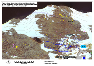
|
Casey Quarry Location View Map Details
Map ID - 13740
Published On - January-2010 Scale - 1 : 2000 Physical Size- 21 x 29.7 cm A4 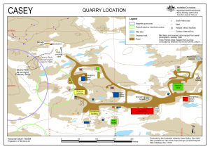
|
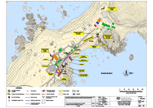
Casey refuelling: initial arrangement for fuel line deployment View Map Details
Map ID - 13745
Published On - January-2010 Scale - 1 : 5200 Physical Size- 21 x 29.7 cm A4 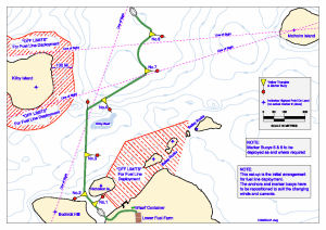
|
Casey Station
|
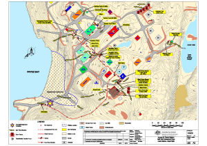
Casey: Fire Hydrants View Map Details
Map ID - 16046
Published On - November-2023 Scale - 1 : 2500 Physical Size- 21 x 29.7 cm A4 Vertical Unit - Meters 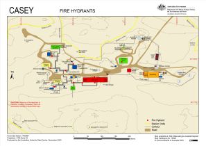
|
Davis Asbestos presence in buildings View Map Details
Map ID - 13937
Published On - June-2011 Scale - 1 : 1750 Physical Size- 29.7 x 42 cm A3 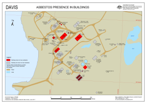
|
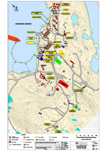
Davis Infrasound Power Supply Cable Route View Map Details
Map ID - 14571
Published On - December-2018 Scale - 1 : 17 000 Physical Size- 21 x 29.7 cm A4 Vertical Unit - Meters 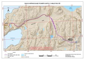
|
Davis IS03 Infrasound Station View Map Details
Map ID - 14692
Published On - December-2018 Scale - 1 : 10 000 Physical Size- 21 x 29.7 cm A4 Vertical Unit - Meters 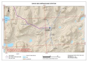
|
Davis Master Plan Issue No. 12 View Map Details
Map ID - 14015
Published On - 23-September-1992 Scale - Not Entered Physical Size- 91 x 145 cm 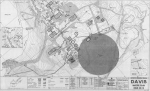
|
Macquarie Island Asbestos Presence in Buildings View Map Details
Map ID - 15938
Published On - September-2023 Scale - 1 : 2500 Physical Size- 21 x 29.7 cm A4 Vertical Unit - Meters 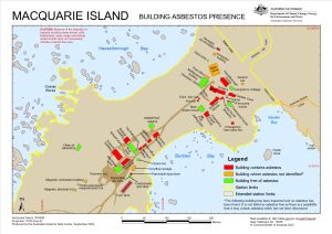
|
Macquarie Island Developmental Plan View Map Details
Map ID - 14498
Published On - 1965 Scale - 1 : 300 Physical Size- 78 x 174.7 cm 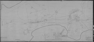
|
Macquarie Island Fire Hydrants (Superseded) View Map Details
Map ID - 13565
Published On - November-2008 Scale - 1 : 1700 Physical Size- 29.7 x 42 cm A3 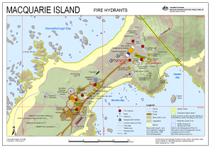
|
Macquarie Island Station Layout View Map Details
Map ID - 14559
Published On - 23-February-1970 Scale - 1 : c200 Physical Size- 91.4 x 106.3 cm 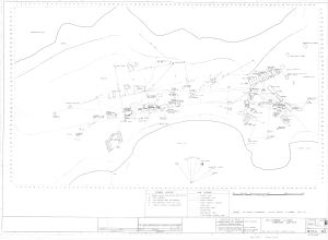
|
Showing 1 to 20 of 23 maps. On page 1 of 2, go to the Next Page