Map 14498: Macquarie Island Developmental Plan
Map details
| Map Number | 14498 |
| Title | Macquarie Island Developmental Plan |
| Edition | - |
| Scale | 1 : 300 |
| Publication date | 1965 |
| Publisher |
Antarctic Division, Department of External Affairs (Australia)
|
| Spatial coverage |
(158.9342° -54.4972°)
,
(158.9408° -54.4972°)
,
(158.9408° -54.5011°)
(158.9342° -54.5011°) |
| Projection | Universal Transverse Mercator |
| Physical size | 78 x 174.7 cm |
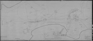
| Notes |
Drawing No. 2/64/04. The plan shows physical features and station infrastructure. |
| Keywords | Survey , Control |
Downloads
This is a hard copy map that has been scanned. See information about obtaining copies of hard copy maps.
Map Lists
This map belongs to the following lists. Use the link on the list to see all maps belonging to that list
Additional Information
Preview