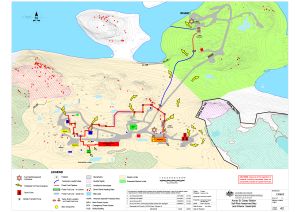
Map 15592: Annex B: Casey Station Spill Risk Assessment Map
Land and Marine-Based Spills
Map details
| Map Number | 15592 |
| Title | Annex B: Casey Station Spill Risk Assessment Map Land and Marine-Based Spills |
| Edition | 9 |
| Previous edition | [Previous edition : 8] |
| Scale | 1 : 2000 |
| Publication date | 13 November 2020 |
| Publisher |
Australian Antarctic Division (Australia)
|
| Spatial coverage |
(110.5181° -66.2775°)
,
(110.5444° -66.2775°)
,
(110.5444° -66.2833°)
(110.5181° -66.2833°) |
| Projection | Universal Transverse Mercator |
| Physical size | 42 x 59.4 cm A2 |
| Notes |
Map to be published in the Australian Antarctic Division fuel spill contingency plans. Please note TIFF is low resolution. |
| Reference |
C/08/02 Revision 4 |
| Keywords | Spill Risk , Drum Farm , Fixed Fuel Pipeline , Valve Drain Location , Mini Oil Spill Kit , ASPA No.135 |
Downloads
This is a digital map available for downloading.
Map Lists
This map belongs to the following lists. Use the link on the list to see all maps belonging to that list
Additional Information
Preview