Fuel Spill Contingency Plan maps

View All Map Lists

Maps produced for Australian Antarctic Division Fuel Spill Contingency Plans

Showing all 5 maps.

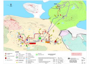
Annex B: Casey Station Spill Risk Assessment Map
Land and Marine-Based Spills View Map Details

Map ID - 15592
Published On - 13-November-2020
Scale - 1 : 2000
Physical Size- 42 x 59.4 cm A2

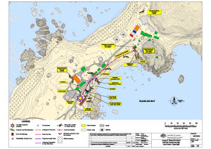
Annex B: Davis Station Spill Risk Assessment Map
Land and Marine-Based Spills. View Map Details

Map ID - 14330
Published On - 19-June-2014
Scale - 1 : 1000
Physical Size- 42 x 59.4 cm A2

Annex B: Macquarie Island Spill Risk Assessment Map
Land and Marine-Based Spills View Map Details

Map ID - 14473
Published On - 2-July-2014
Scale - 1 : 1300
Physical Size- 42 x 59.4 cm A2

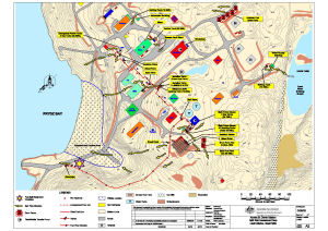
Annex B: Mawson Station Spill Risk Assessment Map
Land and Marine-Based Spills View Map Details

Map ID - 14454
Published On - 1-July-2014
Scale - 1 : 1000
Physical Size- 59.4 x 42 cm A2

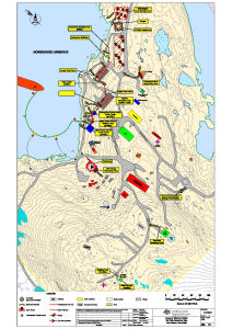
Casey to Wilkins Aerodrome View Map Details

Map ID - 16003
Published On - September-2023
Scale - 1 : 200 000
Physical Size- 29.7 x 42 cm A3
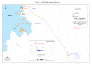
Showing all 5 maps.