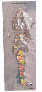
Map 13785: Mawson Escarpment Geology
Map details
| Map Number | 13785 |
| Title | Mawson Escarpment Geology |
| Edition | 1 |
| Scale | 1 : 100 000 |
| Publication date | 1998 |
| Publisher |
Australian Antarctic Division (Australia)
Australian Geological Survey Organisation (Australia) |
| Spatial coverage |
( 67.5000° -72.4667°)
,
( 69.1667° -72.4667°)
,
( 69.1667° -73.7500°)
( 67.5000° -73.7500°) |
| Projection | Universal Transverse Mercator |
| Physical size | 166.5 x 68 cm |
| Notes | The geological data shown in the map is described by the metadata record `Mawson Escarpment Geology GIS Dataset', Entry ID: Mawson_Escarpment_Geo. |
| Keywords | - |
Downloads
This is a digital map available for downloading.
Map Lists
This map belongs to the following lists. Use the link on the list to see all maps belonging to that list
Additional Information
| Horizontal datum | WGS84 |
Preview