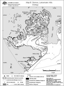
Map 13958: Stornes, Larsemann Hills
Map B: Geology
Map details
| Map Number | 13958 |
| Title | Stornes, Larsemann Hills Map B: Geology |
| Edition | 1 |
| Scale | 1 : 67 000 |
| Publication date | December 2013 |
| Publisher |
Australian Antarctic Division (Australia)
|
| Spatial coverage |
( 75.9614° -69.3878°)
,
( 76.1964° -69.3878°)
,
( 76.1964° -69.4817°)
( 75.9614° -69.4817°) |
| Projection | Universal Transverse Mercator |
| Physical size | 15 x 20 cm |
| Keywords | Geology |
Downloads
This is a digital map available for downloading.
Map Lists
This map belongs to the following lists. Use the link on the list to see all maps belonging to that list
- Larsemann Hills
- Geological maps
- Antarctic Specially Protected Areas and Antarctic Specially Managed Areas maps
Additional Information
| Horizontal datum | WGS84 |
| Vertical datum | Mean sea level |
| Nomenclature | Australian Antarctic Gazetteer |
Preview