Map 13988: Mawson : Local Area
Map details
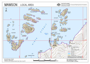
| Map Number | 13988 |
| Title | Mawson : Local Area |
| Edition | 1 |
| Scale | 1 : 27 000 |
| Publication date | September 2011 |
| Publisher |
Australian Antarctic Division (Australia)
|
| Spatial coverage |
( 62.7700° -67.5700°)
,
( 62.9400° -67.5700°)
,
( 62.9400° -67.6100°)
( 62.7700° -67.6100°) |
| Projection | Universal Transverse Mercator |
| Physical size | 21 x 29.7 cm A4 |
| Keywords | Flat Islands , Kerry Island , Jongens Island , Evans Island , Bechervaise Island , Stinear Island , West Budd Island , East Budd Island , Departure Rocks , Marble Rock , Verner Island , Petersen Island , Teyssier Island , Lee Island , Hump Island Dyer Island , Entrance Island , Dyer Island , Field Rock |
Downloads
This is a digital map available for downloading.
Map Lists
This map belongs to the following lists. Use the link on the list to see all maps belonging to that list
Additional Information
| Horizontal datum | WGS84 |
| Vertical datum | Mean sea level |
| Nomenclature | Australian Antarctic Gazetteer |
Preview