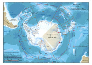
Map 14160: Antarctica and the Southern Ocean: CCAMLR Statistical Reporting Subareas
Includes the Australian Antarctic Territory and year-round Australian stations
Map details
| Map Number | 14160 |
| Title | Antarctica and the Southern Ocean: CCAMLR Statistical Reporting Subareas Includes the Australian Antarctic Territory and year-round Australian stations |
| Edition | 1 |
| Scale | 1 : 47 000 000 |
| Publication date | October 2012 |
| Publisher |
Australian Antarctic Division (Australia)
|
| Spatial coverage |
(-180.0000° -30.0000°)
,
(180.0000° -30.0000°)
,
(180.0000° -90.0000°)
(-180.0000° -90.0000°) |
| Projection | Polar Stereographic |
| Physical size | 17 x 24.4 cm |
| Notes |
Information about data used in this map can be obtained by searching using the following Dataset ids: Antarctic Polar Front: Dataset 33 Bathymetry: Dataset 186 (Qinfos 534, 535, 537 to 540) Antarctica: Dataset 212 CCAMLR Statistical Reporting Subareas: Dataset 206 (Qinfo 655) Map 13580 is a similar map without the Australian Antarctic Territory and year-round Australian stations. |
| Keywords | - |
Downloads
This is a digital map available for downloading.
Map Lists
This map belongs to the following lists. Use the link on the list to see all maps belonging to that list
Additional Information
| Horizontal datum | WGS84 |
Preview