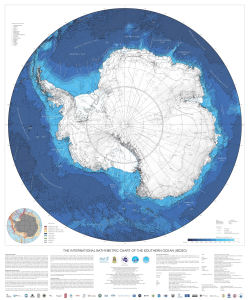
Map 14227: The International Bathymetric Chart of the Southern Ocean (IBCSO)
Map details
| Map Number | 14227 |
| Title | The International Bathymetric Chart of the Southern Ocean (IBCSO) |
| Edition | 1 (Out of Date) |
| Next Edition | [Next Edition : 2] |
| Scale | 1 : 7 000 000 |
| Publication date | June 2013 |
| Publisher |
Alfred Wegener Institute for Polar and Marine Research, Bremerhaven (Germany)
|
| Spatial coverage |
(-180.0000° -60.0000°)
,
(180.0000° -60.0000°)
,
(180.0000° -90.0000°)
(-180.0000° -90.0000°) |
| Projection | Polar Stereographic |
| Physical size | 120 x 100 cm |
| Notes | The IBCSO program is endorsed by international organizations such as the Intergovernmental Oceanographic Commission (IOC) of UNESCO, the International Hydrographic Organization (IHO), and the Scientific Committee on Antarctic Research (SCAR). |
| Keywords | Bathymetry |
Downloads
This is a digital map available for downloading.
Map Lists
This map belongs to the following lists. Use the link on the list to see all maps belonging to that list
Additional Information
| Horizontal datum | WGS84 |
Preview