Map 14317: Vestfold Hills Bathymetry
Map 2
Map details
| Map Number | 14317 |
| Title | Vestfold Hills Bathymetry Map 2 |
| Edition | 1 |
| Scale | 1 : 15 000 |
| Publication date | October 2014 |
| Publisher |
Australian Antarctic Division (Australia)
|
| Spatial coverage |
( 77.7467° -68.5953°)
,
( 77.9464° -68.5953°)
,
( 77.9464° -68.6772°)
( 77.7467° -68.6772°) |
| Projection | Universal Transverse Mercator |
| Physical size | 65.1 x 58.1 cm |
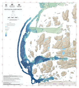
| Notes |
This map displays nearshore bathymetry at the Vestfold Hills, Antarctica. The data is the result of a February-March 2010 survey which was a collaborative project between Geoscience Australia, the Australian Hydrographic Service and the Australian Antarctic Division. |
| Keywords | Suter Island , Donskiye Islands , Redfearn Island , Warriner Island , Hawker Island , Mule Island , Mule Peninsula , Kazak Island , Zolotov Island , Pintado Island , Sorsdal Glacier , Davis , Bathymetry |
Downloads
This is a digital map available for downloading.
Map Lists
This map belongs to the following lists. Use the link on the list to see all maps belonging to that list
Additional Information
| Horizontal datum | WGS84 |
| Vertical datum | Mean sea level |
| Nomenclature | Australian Antarctic Gazetteer |
Preview