Map 14350: Antarctic Specially Protected Area No. 101
Taylor Rookery, Mawson Coast, Mac.Robertson Land, East Antarctica
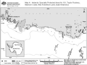
Map A
Map details
| Map Number | 14350 |
| Title | Antarctic Specially Protected Area No. 101 Taylor Rookery, Mawson Coast, Mac.Robertson Land, East Antarctica Map A |
| Edition | 3 (Out of Date) |
| Previous edition | [Previous edition : 2] |
| Next Edition | [Next Edition : 4] |
| Scale | 1 : 475 000 |
| Publication date | March 2015 |
| Publisher |
Australian Antarctic Division (Australia)
|
| Spatial coverage |
( 60.7753° -67.3572°)
,
( 62.9758° -67.3572°)
,
( 62.9758° -67.8608°)
( 60.7753° -67.8608°) |
| Projection | Universal Transverse Mercator |
| Physical size | 15 x 20 cm |
| Notes | The map was produced for the 2015 management plan for ASPA 101. |
| Keywords | - |
Downloads
This is a digital map available for downloading.
Map Lists
This map belongs to the following lists. Use the link on the list to see all maps belonging to that list
- Taylor Rookery
- Antarctic Specially Protected Areas and Antarctic Specially Managed Areas maps
- Mawson Coast
Additional Information
| Horizontal datum | WGS84 |
| Vertical datum | Mean sea level |
| Nomenclature | Australian Antarctic Gazetteer |
Preview