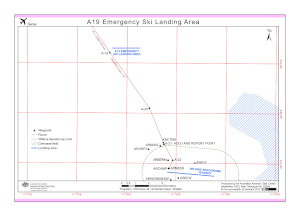
Map 16004: Casey-Wilkins A19 Emergency Ski Landing Area
Map details
| Map Number | 16004 |
| Title | Casey-Wilkins A19 Emergency Ski Landing Area |
| Edition | 3 |
| Previous edition | [Previous edition : 2] |
| Scale | 1 : 75 000 |
| Publication date | September 2023 |
| Publisher |
Australian Antarctic Division (Australia)
|
| Spatial coverage |
(111.2350° -66.5940°)
,
(111.6710° -66.5940°)
,
(111.6710° -66.6940°)
(111.2350° -66.6940°) |
| Projection | Universal Transverse Mercator |
| Physical size | 21 x 29.7 cm A4 |
| Keywords | Casey , Wilkins , A19 , Fixed Wing , Aeronautic |
Downloads
This is a digital map available for downloading.
Map Lists
This map belongs to the following lists. Use the link on the list to see all maps belonging to that list
Additional Information
| Horizontal datum | WGS84 |
| Vertical datum | Mean sea level |
Preview