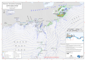
Map 16052: Denman Terrestrial Campaign - Satellite Imagery Holdings
Map details
| Map Number | 16052 |
| Title | Denman Terrestrial Campaign - Satellite Imagery Holdings |
| Edition | 2 |
| Previous edition | [Previous edition : 1] |
| Scale | 1 : 750 000 |
| Publication date | August 2023 |
| Publisher |
Australian Antarctic Division (Australia)
|
| Spatial coverage |
( 95.7706° -65.8019°)
,
(102.5687° -65.8019°)
,
(102.5687° -67.6752°)
( 95.7706° -67.6752°) |
| Projection | UTM 47S |
| Physical size | 29.7 x 42 cm A3 |
| Notes | Map displaying locations of satellite imagery holdings to support the Denman Terrestrial Campaign. |
| Keywords | - |
Downloads
This is a digital map available for downloading.
Map Lists
This map belongs to the following lists. Use the link on the list to see all maps belonging to that list
Additional Information
| Horizontal datum | WGS84 |
| Vertical unit | Metres |
Preview