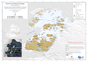
Map 16059: Denman Terrestrial Campaign - RPA operations
Map details
| Map Number | 16059 |
| Title | Denman Terrestrial Campaign - RPA operations |
| Edition | 1 |
| Scale | 1 : 200 000 |
| Publication date | January 2024 |
| Publisher |
Australian Antarctic Division (Australia)
|
| Spatial coverage |
( 99.9400° -65.9000°)
,
(101.6800° -65.9000°)
,
(101.6800° -66.4200°)
( 99.9400° -66.4200°) |
| Projection | UTM 47S |
| Physical size | 29.7 x 42 cm A3 |
| Notes | Map displaying proposed areas of interest (AOI) for RPA operations to support the Denman Terrestrial Campaign. |
| Keywords | Bunger Hills , Edgeworth David , RPA , Remotely Piloted Aircraft , drone |
Downloads
This is a digital map available for downloading.
Map Lists
This map belongs to the following lists. Use the link on the list to see all maps belonging to that list
Additional Information
| Horizontal datum | WGS84 |
| Vertical unit | Metres |
Preview