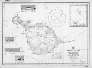
Map 274: Heard Island Survey from 1948 ANARE
Map details
| Map Number | 274 |
| Title | Heard Island Survey from 1948 ANARE |
| Edition | - |
| Scale | 1 : 83 000 |
| Publication date | 01 December 1949 |
| Publisher |
Hydrographic Service, Department of the Navy, Wollongong (Australia)
|
| Spatial coverage |
( 73.1666° -52.9000°)
,
( 73.9833° -52.9000°)
,
( 73.9833° -53.2500°)
( 73.1666° -53.2500°) |
| Projection | Not Given |
| Physical size | - |
| Reference | Aus 08 |
| Keywords | Heard Island , ANARE , soundings |
Downloads
This is a hard copy map that has been scanned. See information about obtaining copies of hard copy maps.
Map Lists
No maps lists available.
Additional Information
Preview