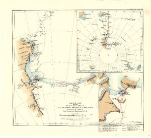
Map 3680: Sketch Map showing the first year's work of the National Antarctic Expedition to illustrate the paper by Sir Clements Markham, K.C.B
Map details
| Map Number | 3680 |
| Title | Sketch Map showing the first year's work of the National Antarctic Expedition to illustrate the paper by Sir Clements Markham, K.C.B |
| Edition | - |
| Scale | 1 : 6 000 000 |
| Publication date | 1903 |
| Publisher |
Royal Geographical Society (United Kingdom)
|
| Spatial coverage |
(130.0000° -66.4516°)
,
(-130.0000° -66.4516°)
,
(-130.0000° -85.0000°)
(130.0000° -85.0000°) |
| Projection | Not Given |
| Physical size | 40.5 x 45 cm |
| Notes | Inset: Ross Island |
| Reference | 861 |
| Keywords | National Antarctic Expedition , Sir Clements Markham , Mount Discovery , Mount Erebus , Mount Terror , Coulman Island , Admiralty Range , Mount Melbourne , Ship Tracks , Historical |
Downloads
No downloads available.
This is a hard copy map. See information about obtaining copies of hard copy maps.
Map Lists
This map belongs to the following lists. Use the link on the list to see all maps belonging to that list
Additional Information
Preview