Royal Geographical Society maps
View All Map ListsShowing 1 to 20 of 42 maps. On page 1 of 3, go to the Next Page
Antarctic Regions : chart to illustrate the paper on the Drift of the "Endurance" by Lieut. J.M. Wordie R.F.A. View Map Details
Map ID - 3700
Published On - April-1918 Scale - 1 : 7 500 000 Physical Size- 34 x 36.3 cm 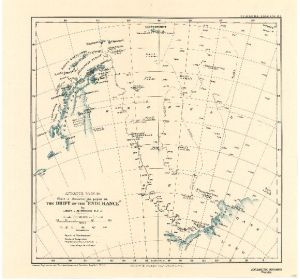
|
Australasian Antarctic Expedition : King George V Land showing tracks of the Eastern Sledging Parties from the Main Base View Map Details
Map ID - 3697
Published On - 1914 Scale - 1 : 1 000 000 Physical Size- 37 x 52 cm 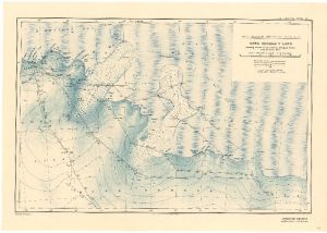
|
Australasian Antarctic Expedition 1911-14 : Queen Mary Land showing tracks of the Sledging Parties from the Main Base. View Map Details
Map ID - 3698
Published On - 1914 Scale - 1 : 1 500 000 Physical Size- 38 x 52.5 cm 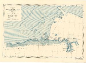
|
British Antarctic Expedition 1907 : General Map showing the Explorations and Surveys of the Expedition 1907-09. View Map Details
Map ID - 3688
Published On - 1909 Scale - 1 : 6 000 000 Physical Size- 44.5 x 44.5 cm 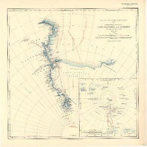
|
British Antarctic Expedition 1907 : Route and Surveys of the South Magnetic Polar Party 1908-09 View Map Details
Map ID - 3690
Published On - 1909 Scale - 1 : 1 500 000 Physical Size- 53.5 x 40 cm 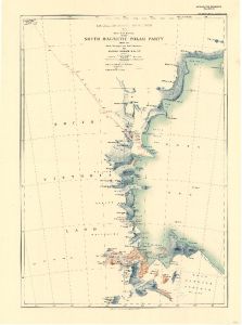
|
British Antarctic Expedition 1907 : Route and Surveys of the Southern Journey Party 1908-09 View Map Details
Map ID - 3689
Published On - 1909 Scale - 1 : 1 500 000 Physical Size- 65.5 x 40 cm 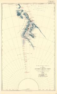
|
British Antarctic Expedition 1910-13 : Sketch map to illustrate the paper by Raymond E. Priestley on The Work of the Northern Party. View Map Details
Map ID - 3699
Published On - 1914 Scale - 1 : 5 000 000 Physical Size- 35 x 37.5 cm 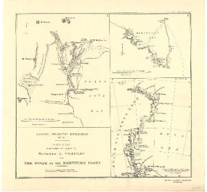
|
British Antarctic Territory : Alexander Island and Charcot Island View Map Details
Map ID - 3719
Published On - June-1963 Scale - 1 : 1 000 000 Physical Size- 50.7 x 38 cm 
|
British Graham Land Expedition : Sledge Journeys and Flights from Southern Base, 1936-7;
|
Chart showing the discoveries and approximate track of Edward Bransfield, Master R.N. in the hired brig "Williams" of Blyth, when exploring the South Shetland Islands and the northern extremity of Graham Land in the year 1820. View Map Details
Map ID - 3701
Published On - March-1925 Scale - 1 : 2 650 000 Physical Size- 25.5 x 38.5 cm 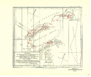
|
Charts showing the Explorations and Surveys of the British, Australian and New Zealand Antarctic Research Expedition from 1929 to 1931 under the command of Sir Douglas Mawson, O.B.E., D.Sc. View Map Details
Map ID - 3705
Published On - August-1932 Scale - 1 : 3 000 000 Physical Size- 44 x 61 cm 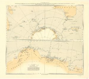
|
Discoveries in Graham Land by Sir Hubert Wilkins, December, 1928. View Map Details
Map ID - 3702
Published On - March-1929 Scale - 1 : 6 250 000 Physical Size- 29.5 x 24.5 cm 
|
Elephant Island : From a survey by the Joint Services Expedition, December 1970. View Map Details
Map ID - 3722
Published On - September-1972 Scale - 1 : 132 000 Physical Size- 24.8 x 40.5 cm 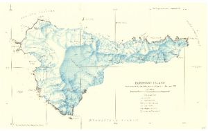
|
Graham Land : British Graham Land Expedition, January 1935 - March 1937 View Map Details
Map ID - 3714
Published On - May-1938 Scale - 1 : 3 500 000 Physical Size- 38.5 x 35.3 cm 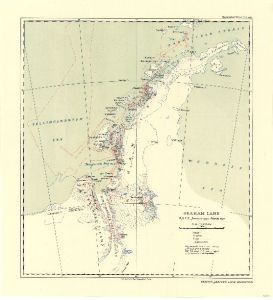
|
Graham Land as known 1934-37 (4 maps) View Map Details
Map ID - 3710
Published On - 1938 Scale - 1 : 12 000 000 Physical Size- 24.5 x 36.5 cm 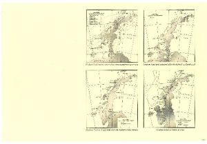
|
Graham Land Coast : B.G.L.E. September 1935 - February 1936 View Map Details
Map ID - 3713
Published On - April-1938 Scale - 1 : 750 000 Physical Size- 24.6 x 33.3 cm 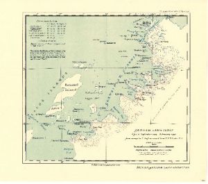
|
Map of a part of the coastline of Victoria Land View Map Details
Map ID - 1086
Published On - June-1900 Scale - Not Entered Physical Size- 44.5 x 48.5 cm 
|
Map showing the Work of the National Antarctic Expedition 1902-3-4 View Map Details
Map ID - 3685
Published On - 1904 Scale - 1 : 2 500 000 Physical Size- 38 x 70 cm 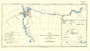
|
Map showing track of the S.Y. "Morning" to accompany Captain W. Colbecks report on the second Antarctic Relief Expedition 1903-04. View Map Details
Map ID - 3686
Published On - 1904 Scale - 1 : 15 000 000 Physical Size- 34 x 28.2 cm 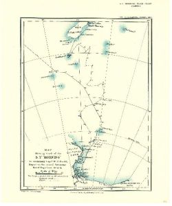
|
Map to illustrate the paper on the "First Crossing of Antarctica" by Lincoln Ellsworth View Map Details
Map ID - 3709
Published On - March-1937 Scale - 1 : 12 000 000 Physical Size- 25 x 52 cm 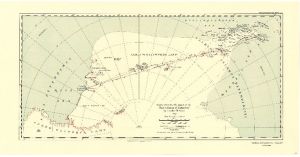
|

Showing 1 to 20 of 42 maps. On page 1 of 3, go to the Next Page